
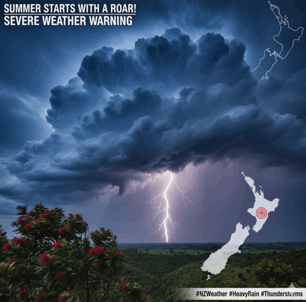
ummer Starts with a Storm: Heavy Rain and Thunderstorms to Lash North Island
AUCKLAND/WELLINGTON – December 1, 2025
Despite the official start of meteorological summer, much of the country is bracing for a week of unsettled and potentially severe weather, with heavy rain, thunderstorms, and strong winds forecast across the North Island and parts of the South Island.
MetService meteorologists warn that a rapidly developing low-pressure system in the Tasman Sea is set to pull a warm, moist, sub-tropical airmass across New Zealand, bringing a stark contrast to the initial sunny spells.
North Island to Face the Brunt
The main weather event is expected to hit the North Island through Tuesday, Wednesday, and into early Thursday, bringing with it a high likelihood of widespread disruption:
- Heavy Rain and Thunderstorms: Regions including Northland, Auckland, and Coromandel are most at risk of torrential downpours and the severe weather associated with thunderstorms. Forecasters advise the potential for surface flooding in vulnerable areas.
- Strong Winds: Strong southwesterly winds are expected to accompany the rain, adding to hazardous conditions, particularly for coastal areas and transportation.
- Humid Start: The North Island will initially experience a warm and humid start to the week, with temperatures in places like Gisborne and Hastings briefly topping 29∘C and 31∘C before the severe weather arrives.
South Island Not Spared
While the North Island takes the worst, the South Island is also set for a mixed bag:
- Cool Change: Cooler temperatures will dominate the South Island throughout the week.
- Rain and Troughs: A trough is expected to bring rain through Monday night and Tuesday, followed by cool southwesterlies. The upper parts of the island, including parts of the West Coast and potentially Marlborough, may also experience a period of heavier rain associated with the low tracking to the north.
Conditions are expected to gradually ease late Wednesday night and clear through Thursday morning, allowing for a return to drier weather and some much-anticipated summer sunshine for many parts of the country by the end of the week.
Advice to Public
The public is urged to stay updated on the latest severe weather warnings issued by MetService, especially those in regions prone to flooding and high winds. Motorists should exercise extreme caution on the roads during the heaviest periods of rainfall and be prepared for potential travel disruptions.


