
Lightning Strike Plunges North into Darkness as Extreme Snow Traps Motorists Across South Island
LIONS ROAR NEWS DESK | WELLINGTON
New Zealand is currently in the grip of a ferocious and geographically widespread weather crisis, with a lightning strike forcing a power grid emergency in the North Island, while heavy snowfall and violent winds have isolated communities, closed key transport routes, and trapped vehicles across the South Island. This latest onslaught marks over a week of destructive weather, testing the resilience of infrastructure and communities nationwide.
Chaos on the Passes: Snow Traps South Island Travellers
A powerful system sweeping across the country has turned key South Island mountain passes into dangerous, impassable corridors. The severity of the conditions is clearly visible on major arterial routes:
- Lewis Pass (SH7) and Haas Pass were severely affected, with reports of cars trapped in heavy snow. NZ Transport Agency Waka Kotahi (NZTA) contractors have been working tirelessly in freezing temperatures to free stranded travellers and clear blockages.
- Porters Pass (SH73) and Arthurs Pass (SH73) are also subject to severe Road Snowfall Warnings, with up to 15cm of snow expected above 700m in some areas. The closures of these major trans-alpine routes effectively sever the vital connection between the East and West Coasts, halting transport and commercial activity.
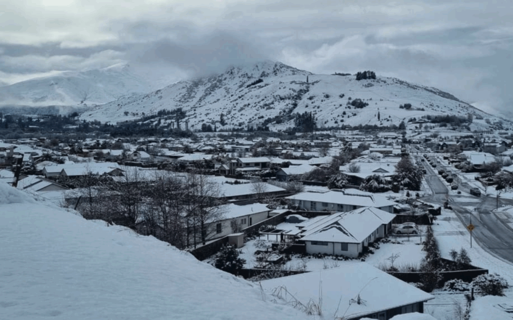
- An Orange Heavy Snow Warning remains in place for the Canterbury High Country, Queenstown Lakes district, and Central Otago until late morning, predicting up to 20cm of snow above 800m. NZTA has issued an urgent warning, advising against all non-essential travel in these regions due to the high risk of disruption and the potential effects of cold conditions on livestock. Furthermore, at least one major road is currently under an avalanche warning, a stark indicator of the extreme risk posed by the deep, unstable snowpack.
Cantabrians have woken up to freezing temperatures, and communities are battling the twin threats of heavy snow and bitter cold, following destructive weather earlier in the week.
North Canterbury Ravaged: Homes and Farms Wrecked
The most severe localised damage is being assessed in North Canterbury, where a violent storm tore through communities like Culverden, Rotherham, and Waiau. Local residents are facing an arduous clean-up operation after powerful winds wrecked homes and caused significant damage to farms.
The sheer ferocity of the weather event—which brought gale-force winds and heavy rain—has been devastating to the region’s vital agricultural sector. Farmers are working around the clock to secure property and ensure the welfare of livestock in the face of ongoing sub-zero temperatures and fresh snow. The ongoing nature of the severe weather means recovery efforts are constantly delayed or complicated, leaving many households and businesses reeling from consecutive meteorological blows.
Lightning Strike Triggers Grid Emergency in the North
Adding to the national crisis, the North Island experienced a sudden and critical power disruption. A single, powerful lightning strike successfully disrupted the power grid in central areas, forcing Transpower, the national grid operator, to issue a Grid Emergency Notice.
A Grid Emergency is a serious measure, typically declared when a major fault or disturbance (like this lightning strike) threatens the stability and security of the entire electricity supply system. This forces immediate, coordinated action to manage the flow of power and prevent a cascading failure, which could result in widespread blackouts. While power has been restored in most areas, the event underscores the vulnerability of critical infrastructure to extreme weather events.
Safety Advisory: Warnings Remain in Effect
The destructive weather pattern has been relentless for over a week, and officials caution that the threat is far from over. Several watches and warnings remain active across the country for the remainder of the day:
- Road Snowfall Warning is in effect for the Desert Road (SH1) from noon to 4 pm Tuesday, with up to 4cm of snow expected near the summit, posing a risk to the North Island’s key central artery.
- Heavy Snow Watch remains for Banks Peninsula until early afternoon, with snow above 300m potentially approaching warning levels, making travel on hill roads difficult.
- Heavy Rain Warnings are also in place for the Bay of Plenty region this afternoon, raising the risk of localised flooding and slips in areas already saturated by recent rainfall.
Authorities are urgently advising all New Zealanders to stay updated with MetService warnings and NZTA road alerts. Those travelling are strongly urged to carry emergency supplies, postpone non-essential journeys, and exercise extreme caution. The national focus now shifts to recovery and ensuring the safety of those stranded or displaced by this extensive and destructive weather event.


