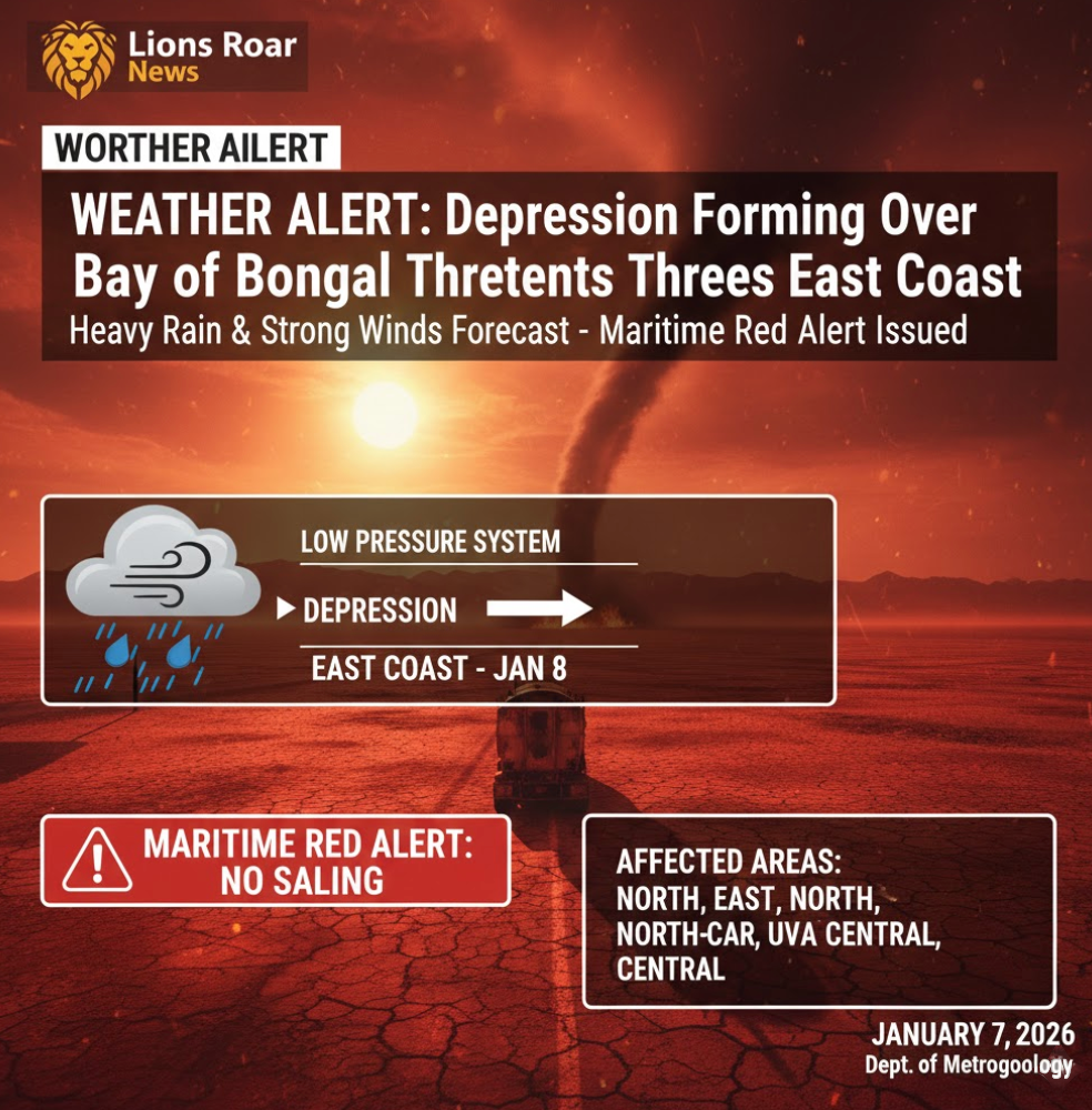
SRI LANKA WEATHER ALERT: Low Pressure System 700km Off Batticaloa Threatens East Coast; Heavy Rain and Winds Forecast
By Lions Roar News Weather Desk
COLOMBO, SRI LANKA (January 7, 2026) — The Department of Meteorology has issued an urgent weather advisory as a low-pressure area currently stationed in the Southeast Bay of Bengal begins its approach toward Sri Lanka.
As of 9:47 AM today, the system was located approximately 700 kilometers off the coast of Batticaloa. Authorities are warning that the system is likely to intensify into a depression within the next few hours.
🌀 System Tracking & Intensification
According to Merril Mendis, Director of the Forecasting Division at the Department of Meteorology, the atmospheric disturbance is moving steadily toward the island’s eastern seaboard.
- Timeline: The system is expected to reach the vicinity of the eastern coast by tomorrow, January 8th.
- Status Change: Currently a low-pressure area, it is forecasted to develop into a Depression—a stronger weather system characterized by lower pressure and higher wind speeds.
- Movement: The system is pulling moisture and wind toward the island, creating unstable atmospheric conditions across the region.
🌧️ Regional Impact Forecast
Residents in the Northern and Eastern half of the country should prepare for a significant increase in rainfall and gusty winds over the next 48 to 72 hours.
| Affected Provinces | Expected Weather Conditions |
| Northern & Eastern | Frequent showers, heavy at times, with strong winds. |
| North-Central & Uva | Intermittent rain and cloudy skies. |
| Central Highlands | Significant rainfall expected; risk of localized landslides in hilly areas. |
Lions Roar News Findings: Based on current satellite imagery, the system’s proximity to the coast suggests that coastal inundation and rough seas are likely. The “wrap-around” effect of the depression may also bring sudden thundershowers to the Western and Southern provinces during the evening hours.
🚫 Maritime and Fishing Warning
A strict Red Alert has been issued for the maritime community. Director Mendis has advised all naval and fishing communities to suspend operations immediately in the following sea areas until further notice:
- Kankesanturai to Trincomalee
- Batticaloa to Hambantota
The seas are expected to be very rough, with swell waves reaching heights of 2.5 to 3 meters in the eastern and southeastern deep-sea regions.
💡 Safety Recommendations
- Monitor Forecasts: Stay tuned to Department of Meteorology updates as the system moves closer.
- Secure Property: Given the forecast for increased wind speeds, secure outdoor items and check roof structures.
- Avoid Waterways: Residents near rivers in the East and North-Central provinces should be wary of sudden rising water levels.
- Emergency Kits: Ensure you have flashlights and basic supplies ready in case of localized power outages.