
Northland Flood Crisis: “Worse than Cyclone Gabrielle” as Marae Open to Shelter Displaced Whānau
By Lions Roar News National Desk
WHANGĀREI, NEW ZEALAND (Sunday, January 18, 2026) — Communities along Northland’s east coast are reeling this afternoon after a night of “extreme and highly concentrated” rainfall that some leaders say has caused damage even more severe than Cyclone Gabrielle.
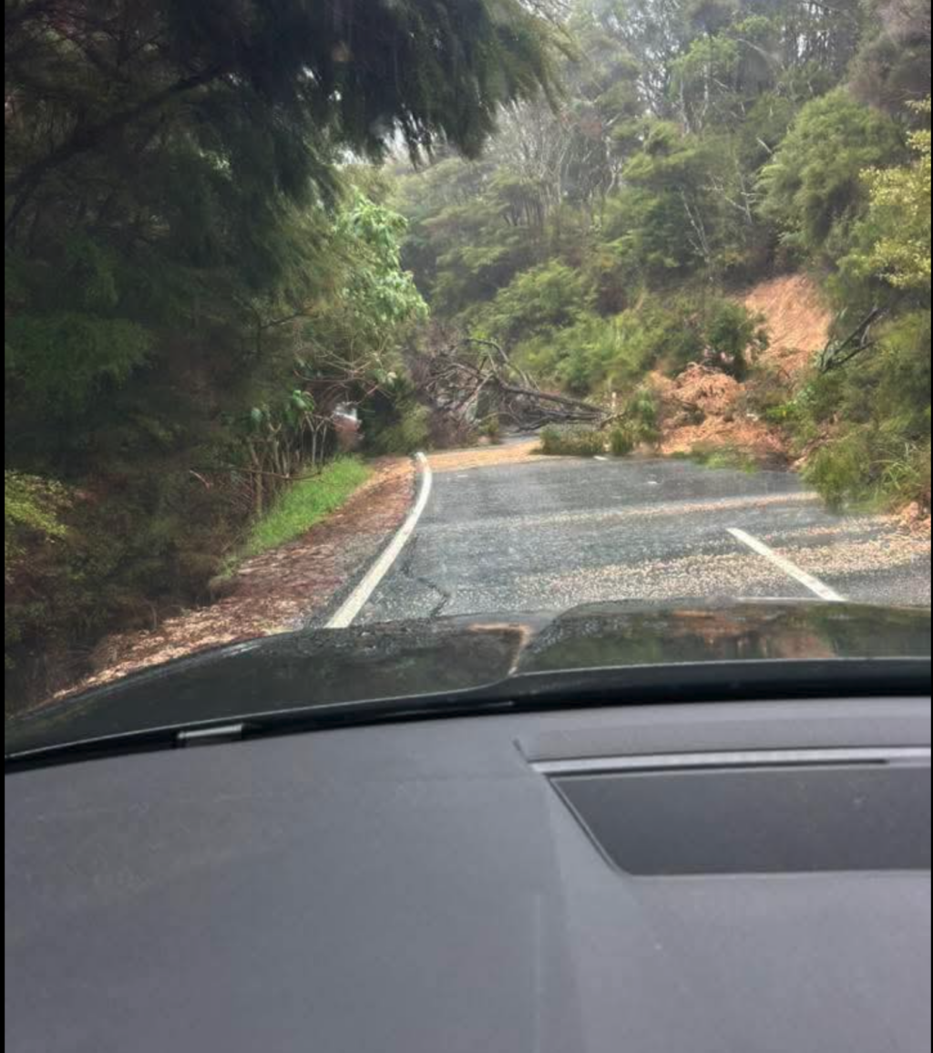
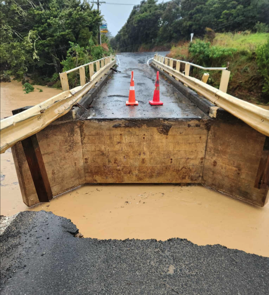
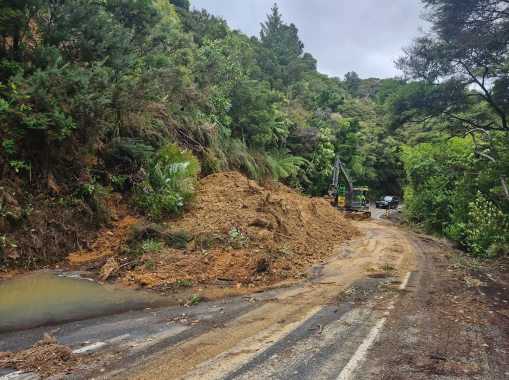
While MetService has officially lifted the Severe Thunderstorm Warning as downpours began to ease around noon, the destruction left behind is widespread. Massive slips, washed-out bridges, and power outages have left hundreds of residents and campers trapped across the region.
🏘️ Iwi and Marae Lead the Rescue Effort
In a powerful display of community resilience, the Ngātiwai Trust Board has activated its emergency response, opening several marae to act as Civil Defence Centres.
- Shelters Open: Displaced whānau and community members are being sheltered at Tuparehuia (Bland Bay), Ngāiotonga (Punaruku), Ōtetao, and Mōkau marae.
- The Scale of Damage: “While we endured Cyclone Gabrielle, the impacts we are seeing now feel even more severe in some areas,” the Trust Board stated, citing flooded homes and destroyed infrastructure across their rohe (territory).
⛈️ Lightning Strikes and Power Outages
The storm’s ferocity was felt not just in the water levels but in the sky. Northpower reported that over 750 homes were plunged into darkness across Ōakura, Punaruku, and Whangaruru, with many outages caused by direct lightning strikes. Top Energy also reported significant cuts in Totara North and Rawhiti.
🚧 Trapped Campers and Townships Under Water
The coastal township of Ōakura has been particularly hard hit.
- Community Hall Flooded: Residents were stunned to find the recently renovated community hall submerged.
- Elliot Bay Escape: Scores of campers who were trapped at the Elliot Bay campground due to a damaged bridge and slips at Taupiri Bay were only able to escape this afternoon once the tide receded enough to navigate the Rawhiti bridge.
- Rainfall Records: Some residents in the Bay of Islands reported a staggering 280mm of rain overnight, with radar estimates suggesting up to 200mm fell over the eastern hills north of Whangārei in just 12 hours.
🌦️ Forecast: A Grim Monday Ahead
MetService Meteorologist Bevlin Lynden noted that while the “most significant rain” has moved offshore, Northland isn’t in the clear yet.
- Lingering Showers: Showers will continue to hang around the east coast and inland areas.
- Cloudy Skies: Don’t expect the sun to return quickly; heavy cloud cover is forecast to remain until at least Monday.
- Watching the South: Heavy Rain Watches remain active for Great Barrier Island, the Coromandel, and Gisborne/Tairāwhiti until 2:00 PM today.


