
Atmospheric River Alert: Northern NZ Braces for More Heavy Rain and Tropical Low Threat
By Lions Roar News Weather Desk
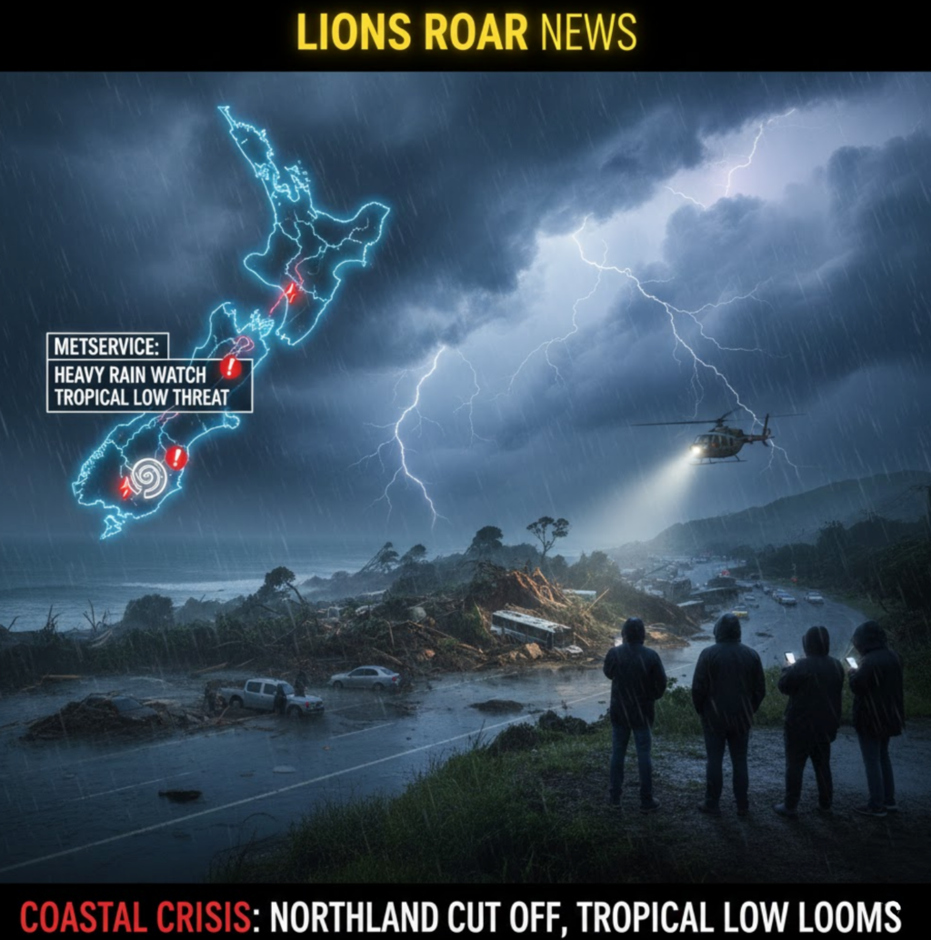
AUCKLAND, NEW ZEALAND (Monday, January 19, 2026) — Parts of the upper North Island are on high alert today as MetService issues fresh heavy rain watches for regions already struggling with saturated ground and damaged infrastructure.
A strong, humid easterly flow is set to dump significant rainfall across Northland, Auckland, and the Coromandel Peninsula starting this evening, with the added threat of a tropical-origin low-pressure system arriving by mid-week.
🌧️ Heavy Rain Watches: The Timeline
MetService has warned that periods of heavy rain, severe thunderstorms, and localized downpours are likely over the next 48 hours.
| Region | Start Time | Duration |
| Northland | 6:00 PM Monday | 18 Hours |
| Auckland (North of Bridge) & Great Barrier | Midnight Monday | 15 Hours |
| Coromandel Peninsula | Midnight Monday | 24 Hours |
Forecasters warn that because the ground is already “saturated” from Sunday’s deluge, even moderate rainfall could trigger fresh flooding and slips.
🏚️ Northland and Gisborne: A Region Under Water
The incoming rain follows a weekend of “torrential” weather that has already left some communities cut off.
- Northland Damage: Early Sunday morning saw up to 200mm of rain in some areas, washing out bridges and damaging homes. In Ōakura, a recently renovated community hall was flooded, and several residents were forced to evacuate to nearby marae.
- SH2 Waioweka Gorge Closure: The main artery between Gisborne and Ōpōtiki remains shut. NZTA announced the highway could be closed for several weeks after 322mm of rain (double the January average) caused 40 slips. Over 40 people had to be rescued by helicopter after being stranded by the rising water and debris.
🌀 The Tropical Low: Mid-Week Uncertainty
While Monday and Tuesday bring immediate concern, MetService is keeping a close watch on a low of tropical origin expected to approach the North Island on Wednesday.
The forecaster noted that the path and strength of this system are currently “very uncertain.” However, the most likely track would see it pass over the central North Island, potentially bringing gale-force east to northeast winds and widespread heavy rain to both the North and South Islands.
⚠️ Safety Advice for Residents
With the threat of localized downpours and thunderstorms, North Island residents are advised to:
- Clear Gutters: Ensure drains and gutters are free of debris to handle sudden heavy flow.
- Check Road Status: Avoid non-essential travel in Northland and the Waioweka Gorge area.
- Stay Informed: Monitor subsequent forecasts as the track of the tropical low becomes clearer.


