
Severe Weather Alert: Deep Depression Approaching Sri Lanka; Heavy Rainfall Exceeding 150mm Expected
By Lions Roar News Weather Desk
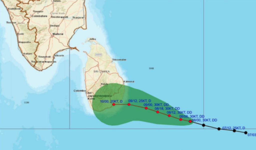
COLOMBO, SRI LANKA (January 9, 2026) — Sri Lanka is on high alert as a Deep Depression in the Southeast Bay of Bengal edges closer to the island’s coast. According to the Department of Meteorology, as of 2:00 PM yesterday (January 8), the system was located approximately 250 km southeast of Pottuvil.
The system is projected to move West-Northwest across the Southwest Bay of Bengal and is highly likely to make landfall between Hambantota and Kalmunai tonight, January 9, 2026, between 5:30 PM and 11:30 PM.
🌧️ Rainfall Forecast: Red Zones Identified
The island is expected to be shrouded in heavy cloud cover, with intense rain and thunderstorms forecast for several provinces.
- Extreme Rainfall (150mm+): Very heavy falls exceeding 150mm are expected at some places in the Eastern Province, as well as the Mullaitivu, Vavuniya, Kilinochchi, and Polonnaruwa districts.
- Heavy Rainfall (100mm+): Significant rainfall exceeding 100mm is likely in the Uva Province and the Nuwara Eliya, Matale, and Mannar districts.
- General Conditions: Occasional showers or thundershowers will occur in Northern, North-Central, Eastern, Uva, Central, North-Western, and Southern provinces, with scattered showers elsewhere.
💨 Wind Warning: Gusts up to 70 km/h
Strong winds are a major concern as the system approaches the coast.
- Sustained Winds: Wind speeds of 50–60 km/h are expected across the eastern slopes of the central hills, and the Northern, North-Central, North-Western, Central, Uva, Eastern, and Southern provinces.
- Gale Force Gusts: High-intensity gusts reaching up to 70 km/h are possible, particularly in the Gampaha and Colombo districts.
⚠️ Public Safety Advisory
The Department of Meteorology and Disaster Management authorities urge the public to take immediate precautions:
- Lightning Safety: Seek shelter indoors during thundershowers to minimize the risk of lightning strikes.
- Structural Hazards: Be wary of temporary structures, trees, and power lines that may collapse under high wind speeds.
- Marine Warning: Naval and fishing communities are advised not to venture out to sea in the affected areas until further notice.


